
Maximum gains for Maritime economy as Navy begins survey, charting of Nigeria’s offshore waters – Amaechi
The Minister of Transportation, Rt. Hon. Rotimi Amaechi, has expressed confidence of maximum gains from the nation’s maritime space as the Nigerian Navy Ship LANA commences full survey and production of nautical charts of the nation’s offshore waters.
Prior to this effort, the nation’s waters have been fully surveyed and charts produced by the UK Hydrographic Office.
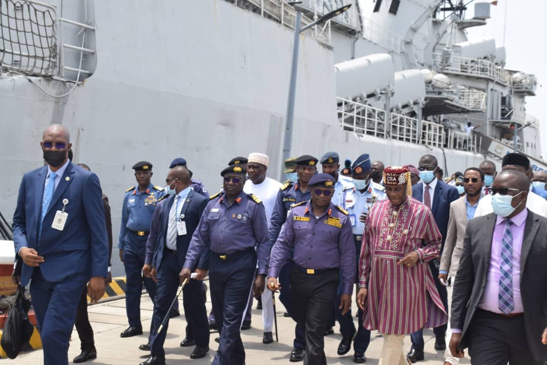
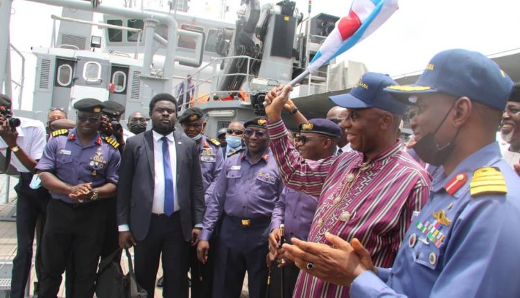
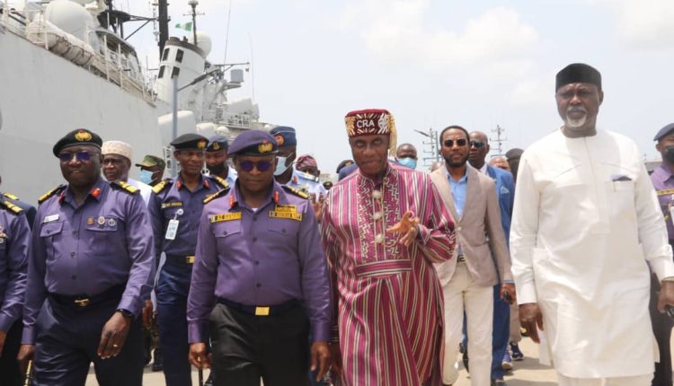
Amaechi was speaking on Wednesday at the Headquarters of the Western Naval Command, Apapa, where the flag-off ceremony of the navy’s preparation to begin a fully-indigenous hydrographic services, took place.
He noted that the ability of a littoral nation to systematically conduct hydrographic survey of their waters for necessary nautical information would ensure safety, enhance security and maritime economic activities.
“Littoral states with developed hydrographic capacity would enhance safety of navigation and effective exploitation of marine resources within its waters.
“Such state would also be able.to produce military graded charts for successful conduct of maritime operations in support of set national objectives,” Amaechi said.
The minister also noted that economic gains of these hydrographic services would include support for the upcoming deep seaports as well as improvement of existing ports, with hopes of creating over two million new jobs.
His words: “As this vessel commences the survey of Nigeria’s offshore today, it is expected that it would provide necessary enablers to support the Federal Government’s Presidential Economic Diversification Initiative through improved maritime security, maritime trade and transport, as well as improved economic prosperity of Nigerian citizens.
“It is also expected that at the end of this survey and charting campaign, up-to-date indigenous nautical products would be available to facilitate smooth take-off of the new deep seaports that are under construction at various parts of our offshore areas.
“Additionally, completion of this survey and charting operation would equally boost confidence of most mariners to increase patronage of Lagos, Port Harcourt and Calabar ports, just as the Warri, Sapele and other ports that are hitherto operating at lowest level would be reactivated.
“This would provide well over two million direct and indirect jobs, increase economic viability of these ports and ultimately decongest Lagos traffic, reduce pressure on our roads, as more cargo ships would call at the nearest ports to the final destination of the goods and services on board.”
In his speech, the Chief of Naval Staff, Vice Admiral Awwal Gambo, expressed delight that operations by the navy’s hydrographic team would begin a new era of improved safety in navigation with expected positive effect supporting shipping and overall economic growth.
He said: “The first attempt to conduct a systematically hydrographic survey of Nigeria’s offshore waters was in the 19th Century, during the British colonial rule when the United Kingdom’s Hydrographic Office surveyed and produced charts for navigation.
“As effective as these surveys were then, technological advancement in ship building over time has made the use of these survey equipment obsolete, ineffective and inadequate for chart production considering the volume of traffic transiting the maritime commons.
“Regrettably, the nautical charts and publications produced with these survey data still form the bulk of aids to navigation that supports over 4000 ships that call at various Nigerian Ports annually…this situation is about to change , as the Nigerian Navy commences survey of Nigeria’s offshore waters in a more systematic way, using state-of-the-art survey equipment borne on board NNS LANA.
“This will be the first time a Nigerian owned survey vessel, manned by Nigerian Navy personnel will be conducting systematic hydrographic survey of our offshore waters. The implications of this is that in the next few years, indigenously produced up to date nautical charts and publications would be available for mariners’ use within Nigerian waters. This would not only replace old Admiralty charts currently used, it would also lead to increased safety within our waters, boost confidence of mariners leading to increased shipping traffic into various Nigerian Ports, for enhanced national prosperity. ”
The CNS gave assurances on the competences of the NNS LANA crew, who had undergone various hydrographic trainings since the ship’s maiden voyage from France to Nigeria on 17th May, 2021.
He also disclosed that “..to further consolidation the capacity of the Nigerian Navy Hydrographers, the NN and the University of Lagos last month signed a Memorandum of Understanding for partnership in hydrographic survey.”
In his remarks, the Flag Officer Commanding Western Naval Command, Rear Admiral Yakubu Wambai, said the commencement of this survey campaign would enable Nigeria take ownership of charting its waters, a worthy effort to improving maritime trade and grow the economy.
His words: “This has the potential of opening the maritime domain for improved maritime trade, efficient harvest of marine resources and effective maritime governance.
“Accordingly, these would help enhance maritime safety, socio-economic development and the prosperity of ordinary Nigerians and ultimately National Security.”
The Hydrographer of the Nigerian Navy, Rear Admiral Emeka Okafor, told the gathering that prior to this time, a 2017 study conducted by the Nigerian Navy Hydrographic Office revealed that only one per cent of Nigeria’s coastal and offshore waters had charts with survey data of between 1-5 years old.
He added that” while about 9 per cent have survey data of between 6-100 years and above. The remaining 90 per cent of Nigeria’s offshore waters are neither surveyed nor charted to modern standard.”
According to the hydrographer, the situation prompted the Nigerian Navy to develop a National Surveying and Charting Plan in 2018, in order to focus the Federal Government’s efforts towards a systematic survey and charting of the nation’s coastal and offshore waters.
That effort enabled Nigeria produce charts in 2019, using local boats constructed by the Naval Dockyard Limited, Lagos.
It surveyed Lagos harbour and produced Nigeria’s first indigenous navigational paper and electronic charts, which were reviewed and accepted by the International Centre for Electronic Navigational Charts and the International Organisation, leading to the chart being allocated International number in 2021.
The ceremony continued with NNS LANA taking a sail to sea for survey and charting.